Tag Archives: Stellarium

Cuatro Puertas: a landscape for Stellarium

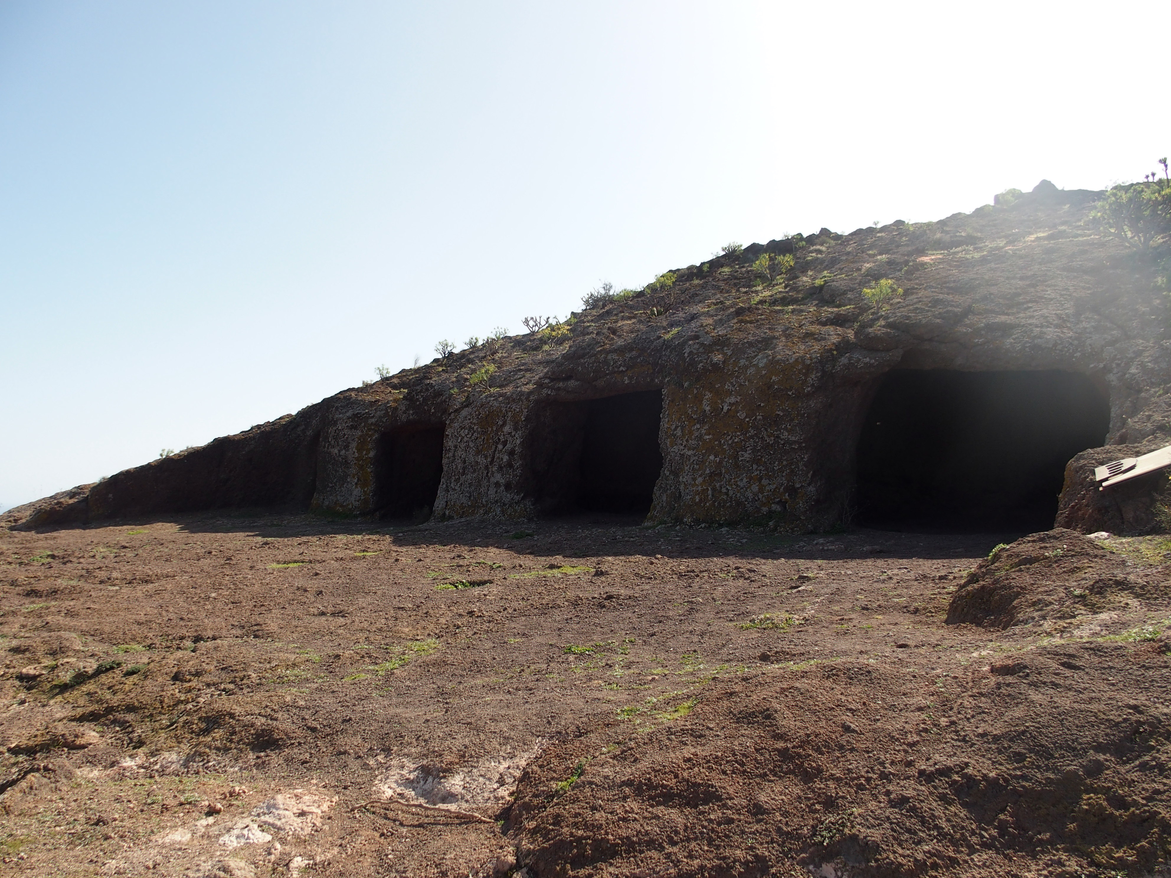
The esplanade and the four entrances that precede the main cave of Cuatro Puertas archaeological site (source: PROYECTO TARHA).

In an earlier post, we advocated the creation of a repository of Canarian landscapes of archaeological interest, for use in Stellarium. Today we want to break the ice with a landscape prepared by ourselves, corresponding to the archaeological site of Cuatro Puertas, located in Telde, Gran Canaria. This place was declared in 1972 Historical-Artistic Monument by the Spanish State –together with Cueva Pintada at Gáldar– and Property of Cultural Interest by the Government of the Canaries.

(more…)

Más / More...

Using Stellarium in Archaeoastronomy

Canopus’ heliacal rising simulation (circle right above the horizon) in 1478 seen from the coordinates of modern Las Palmas de Gran Canaria city. Simulation landscape does not correspond to the real location (source: PROYECTO TARHA).

In our previous post we showed two videosimulations of the solar eclipse that took place on April 29th, 1478. This time we shall discuss a piece of software used to perform those simulations: Stellarium.

Stellarium is multiplatform, free software which works as a planetarium. As such, we can use it to simulate the position of celestial bodies visible from any geographic location on Earth at a specific time and date, accurately enough even for astronomical events two or three millenniums before our Era, which makes it very valuable in the field of archaeoastronomy.

(more…)

Más / More...